Kayak Launch Location
![]()
![]()
Directions
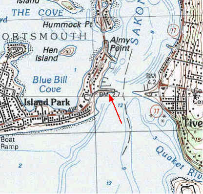
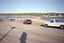
Old Stone Bridge, Portsmouth: (CRMC designation under review) Directions from Rt 24/Rt 138 north or south, take the Hummock Ave exit and go south to the site. From Rt 114 north or south, exit at Boyds Lane go south to Park Ave., and take a left. Located off Point Road, this site is the western end of the 1907 stone bridge over the Sakonnet River between Portsmouth and Tiverton. The bridge was partially destroyed in the 1954 hurricane, but the abutment has been converted into a fishing pier and parking area. Currently (2004) the pier itself is closed off. There is a small marina and boat ramp near the bridge and a State Beach (Teddy's Beach) just south of the bridge.
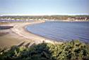
Teddy's Beach: (State Beach property) Located at the end of Park Avenue, on Point Road, adjacent to the Old Stone Bridge, this State-managed area has a small crescent of sandy beach with a sloping grassy area behind it. Limited parking is available for about a dozen cars on the street and on the Old Stone Bridge.