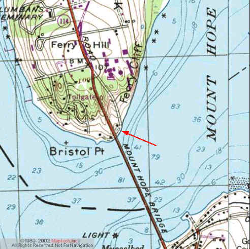
Kayak Launch Location
![]()
![]()
Directions
Ferry Road, Bristol (CRMC designation none) Directions from Rt 114 north or south. Look closely for a sharply angled side road that drops down on the east side of the Mt Hope Bridge, just north where the old toll booths were located. Situated almost under the Mount Hope Bridge and next to Roger Williams University, this paved road leads to a cobble beach on Mount Hope Bay. "No Parking" signs are posted. (Not sure of the current status of parking since cars have been seen parked there.)