Kayak Launch Location
Directions
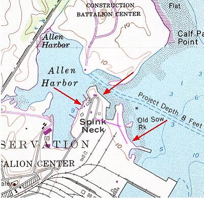
(The
only accurate map of the Quonset Point area, 3 meg download.)
![]()
![]()
Spink's Neck Beach: (Quonset Development Corp.
managed for RI State ) Within the Quonset Point Industrial Park.
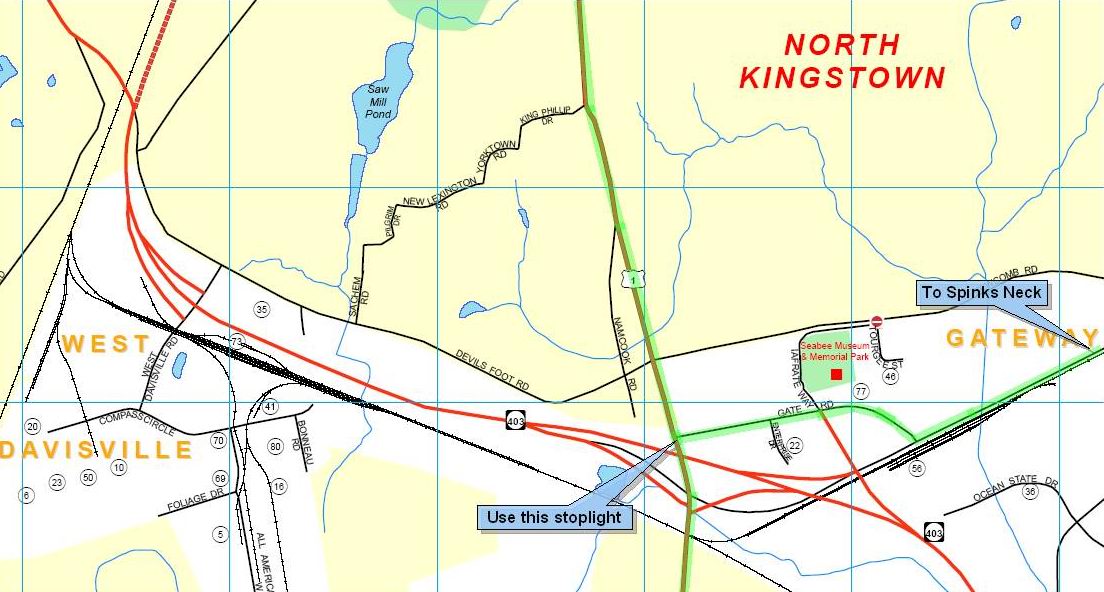
Directions from Rt 95, exit to Rt 4 south, take Exit 7
at Rt 402/403 (to Quonset Pt) and continue on Rt 403. Stay on the
expressway, (do not exit at W. Davisville Rd.) Continue on the
expressway and follow the signs to Davisville, not Quonset Pt.
Continue on Davisville Rd as below.
Directions from the
south on Rt 1. At the Rt 4/Rt 1 fork, just north of the access
highway to the Jamestown Bridge, do not take Rt 4 at the
stoplight, but fork to the right and stay on Rt 1 to North Kingston.
Go 4 miles to the new overpass, (map)
at the first stoplight do not take the exit to Rt 403 east,
but use the second stoplight on on the north side of the overpass to
turn right to Gate Rd (sign also reads Rt 403 east) At the end of
Gate Rd, take a left on Davisville Rd.
Directions from the
north on Rt 1. Just past the stoplight at Devils Foot Rd., turn
left at the first stoplight (map)
on the overpass, on to Gate Rd., labeled Rt 403 east. At the end of
Gate Rd, take a left on Davisville Rd.
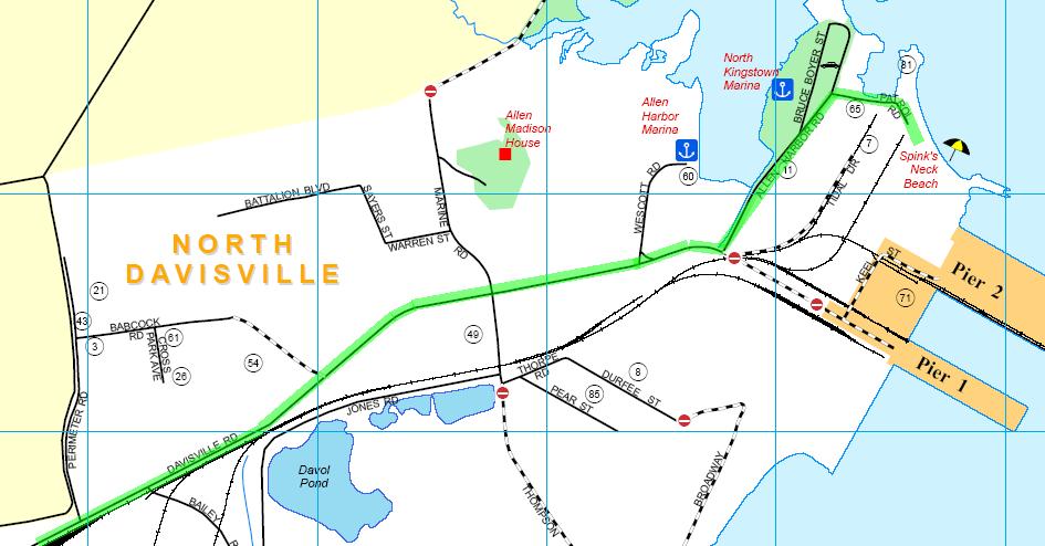
On Davisville Rd.
continue about 2 miles (map)
to the end. Turn left (Access straight ahead is restricted to the
Davisville Port.) onto Allen Harbor Rd. If you stay straight on Allen
Harbor Rd., you will see on your right the access road to Spinks Neck
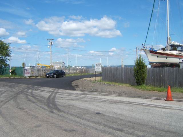
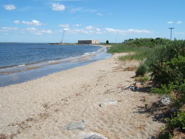
Beach. This new access road is in magenta in the map above. A new
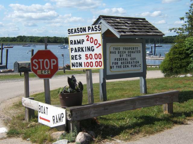
sign for Spink's Neck Beach is at the road entrance, photo 1 above.
Ignore the “Authorized Access Only” sign which refers to
the marina. Continue on the newly paved access road to the end. The
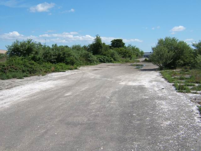
dirt potholed road heading south that leads to an old paved area,
photo 3 above is closed as of 2009. There are no sanitary facilities
near the beach but plenty of bushes for privacy. There is a new
restroom near the Allen Harbor ramp (which may be locked at times),
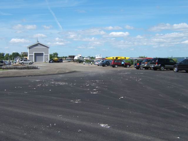
and portable toilets (not locked) in that area. A new parking area
for accessing the upper end of the beach is at the end of the newly
paved access road, as in photo 2 above. As of spring 2000 new
(bilingual) signs have been installed.
![]()
![]()
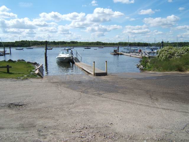
Allen Harbor: (CRMC designation under review, but ramp owned by Town) Within the Quonset Point Industrial Park. Follow the directions as above, but once beyond the Davisville Port, take the first road bearing to the left (new sign as of 2009) which leads to the North Kingston Town boat ramp. There is a fee for boat launching, note the irony in the photo. The location of the ramp is the left arrow above. There is a new restroom next to the parking lot and portable toilets just to the north.
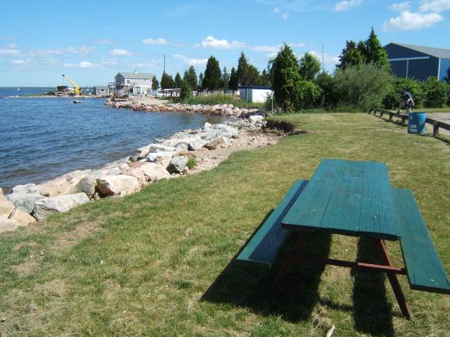
An alternate launch near the Allen Harbor channel is the end of the loop road. If not a great launch site, it is a nice picnic site. If you continue past the Spinks Neck Beach turnoff, you will end up at the end of the loop which is a public grassy area that has a rocky hand carry launch. There appears to be plenty of parking on the dirt/grassy area at the end of the loop. This site has an exposed partially rocky bottom at low tide.