Index of videos
https://youtu.be/gMhAGI91v2k |
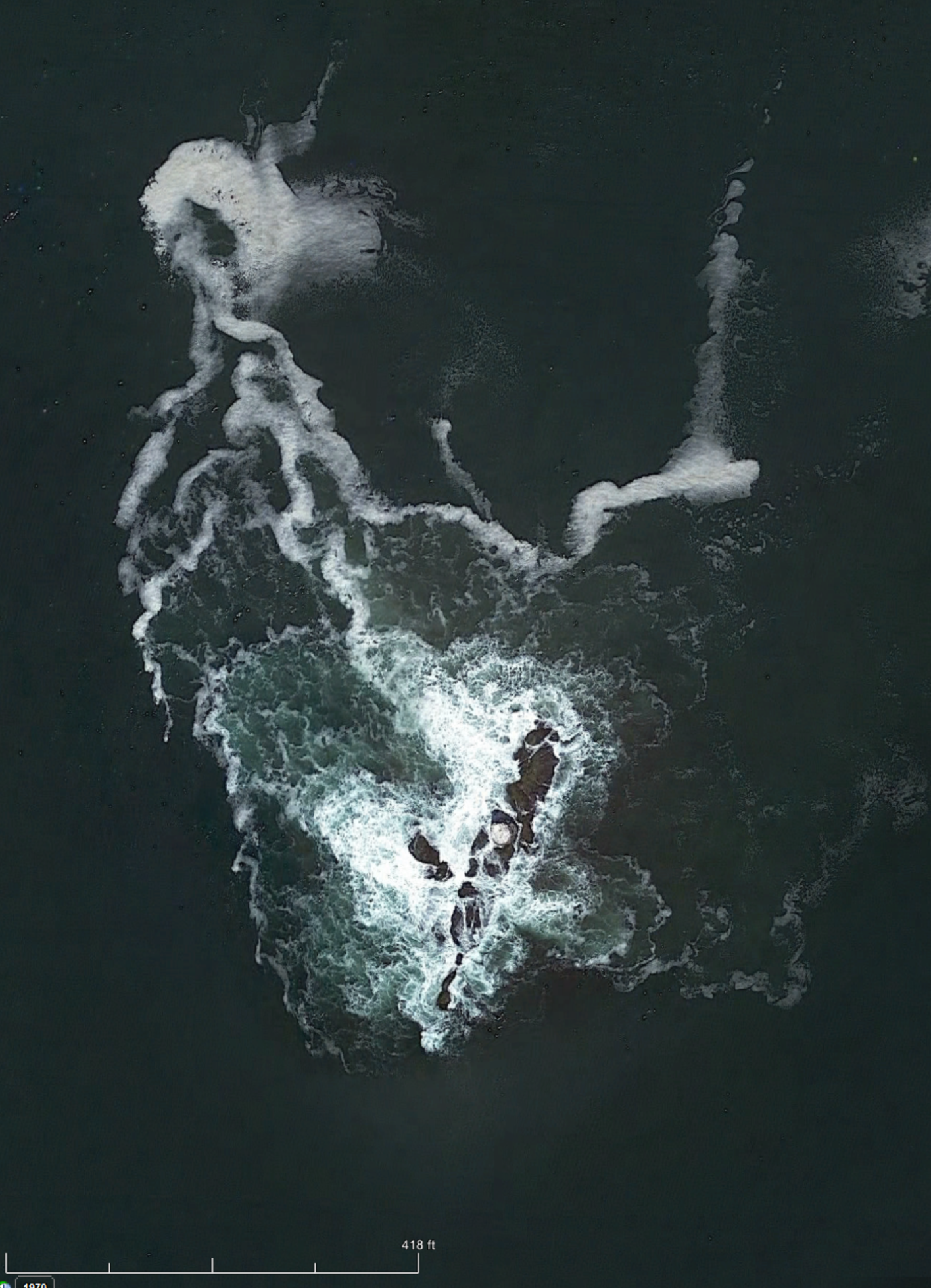
Sakonnet Point, MA - July 25, 2019 - The weather was perfect, sunny, in the mid 70's with a light onshore breeze. Leaving from the Fishing Access launch in Sakonnet Harbor, RI, we paddle out and around the rock breakwater and head toward the lighthouse. The general surf direction was from the southeast, with swells only a foot or so in among the islands. After going around the light house we paddled over to West Island but since there was no landing other than a rocky shore, we decided to head back toward the Sakonett point for a lunch break. The "point" is actually a stable sand spit, maintained by wave action coming from both sides. The video shows the interesting dual and opposing wave action. After lunch we headed around the spit and eastward. In a short time we turned back because of time constraints, plus the shore break (exposed away from the protecting islands) might be a landing problem. There were only two of us and only one had experience in landing in surf. To locate the route on Google Earth, use this gpx link. The Google Earth route is in this image.
https://www.youtube.com/watch?v=xH48uBvWDJY |
Beavertail Point, Jamestown, RI - July 26, 2019 - This is an edited down version of a full video to follow. The weather was perfect, sunny, in the mid 70's with a light onshore breeze. Leaving from the URI Bay campus, the conditions were such that we decided it would be a nice day to head out to Beavertail. On the way out we stopped to see the natural blow hole. Even mild swells produced a nice spray. Since the sea was pretty calm we paddled out to the outer buoy off Beavertail point. Coming back in from the buoy we stopped to view the small surf off Beavertail. To locate the route on Google Earth, use this gpx link. The Google Earth route is in this image.
https://www.youtube.com/watch?v=dS1-97CjMXQ |
URI Bay Campus to Whale Rock, RI - August 18, 2020 - A Level 2 paddle from the URI Bay Campus to Whale Rock in Narragansett Bay. The wind was from the south southwest and our route was in the lee of land for most of the paddle, making it an easy and pleasant paddle. When we lost the land protection from the wind, the 15 kt wind made the paddling more difficult and produced a quick chop to Whale Rock. Once at the rock, the natural smallish cove on the NW did not give the protection that I expected for my paddling partner. It would be proper to call it Level 3 around the rock. So we only stayed for a few minutes before turning around and heading back north. Heading back was much easier with the onshore wind and following sea. The air and water temperatures were in the 70's so it was a pleasant paddle, with a touch of excitement. To locate the route on Google Earth, use this gpx link.The Google Earth route is in this image.
https://www.youtube.com/watch?v=c3mLDuxgujo |
Pollock Ave to Narrows, RI - August 21, 2020 - This is a day kayaking from Pollock Ave public access, down the Pettaquamscutt river to the Narrows at Narragansett, RI. Nice warm weekday without summer crowds on the sand spit at the Narrows. This image shows the paddle route. Tidal flow and storms move and manage the sand in the area from one season to another. Out going tide this day provided two nice float downs into the Narrows. The outdoing tide and the strong on-shore wind caused rough water conditions at the entrance of the Narrows. A life was lost in similar conditions when recreational kayakers came down the Narrows in cold weather and capsized. Our second float shows the wave action. To locate the route on Google Earth, use this gpx link.
https://www.youtube.com/watch?v=bEAl7NJCXSc |
Ft. Wetherill along Beavertail, RI - September 4, 2020 - A paddle from Ft. Wetherill boat ramp to the Eastern shore of Beavertail, Jamestown, RI. A warm day with good wind for many sailing boats in the outer Bay. The wind was from the SW and strong enough to limit our paddle short of reaching Beavertail Pt. On the way back two of the 12 meter tour boats from Newport passed near enough for photos. The paddle route is in this image. To locate the route on Google Earth, use this gpx link.
https://www.youtube.com/watch?v=vbGeLIysrz4 |
Weaver Cove to Hope Island, RI - September 5, 2020 - A long day of paddling from Weaver Cove to Dyer Island, to Prudence Island, to Hope Island and back. Returning to Weaver at 6:00 pm. The day was quite interesting because of a front passing at about 3 pm. This caused a spike in wind from the southeast resulting in a heavy wind chop as we exited Hope Island. These images show NOAA plots of the wind and of wind gusts peaking at 15 hrs EDT. The other kayakers in our group got back to Weaver Cover ahead of the rough water.
At the end I mention in a humorous way of being 'famous' for all my photos on the Web. This comment was from another kayaker (of 4) pulling into the launch site as we did, who obviously cherished kayaking photos. These 4 had paddled all the way from Oakland Beach (about 10 miles) and after a beach supper headed back to Oakland Beach. We assume that they got back safely late at night since we saw no "lost kayakers" in the morning news. To locate the route on Google Earth, use this gpx link.
https://www.youtube.com/watch?v=u9m-ukJtDvM |
Goddard Park to Rocky Point, RI kayaking - November 7, 2020 - A kayak paddle in Narragansett Bay from Goddard State Park, RI, to Rocky Point Park, Warwick. A nice warm sunny pleasant day made it a perfect paddle for the end of the 2020 season. Total trip length was about 11 miles.
https://www.youtube.com/watch?v=t3nDyqPUNpc |
Wickford Moonlight Paddle - June 24, 2021 - An evening moonlight paddle where no women accepted the offer. Clouded over so no moon, but replaced with dark night and light rain. Launching from a little beach from the Wickford Town dock. The paddle reached Green Point pond which afforded a nice sunset and somewhat rainbow. To locate the route on Google Earth, use this gpx link. The paddle route is in this image.
https://www.youtube.com/watch?v=svhBZFxsNA8 |
Spinks Neck beach to Patience Island - August 27, 2021 - An easy paddle to Patience Island in Narragansett Bay on a windless hot humid day. Hot enough for paddling in a white cotton tee shirt. Glassy smooth water most of the day. A passing thunderstorm on land never made it over the Bay. To locate the route on Google Earth, use this gpx link. The paddle route is in this image.
https://www.youtube.com/watch?v=mjpAbFPUWs4 |
Bold Point Park to Pawtucket Falls - May 26, 2022 - Only two of us doing a Spring paddle from the Bold Point Park boat ramp up the Seekonk River to the Pawtucket Falls. The Falls are just below the historic Slater Mill and dam. A breezy day with a strong wind from the south eased paddling upstream but was a workout going back to the launch. The shoreline has scraps and remnants of many vessels that have been abandoned to just decay away. The Falls today has an operational hydro station just below the Falls. This accounts for the volume of water flowing out from the brick building on the west bank. To locate the route on Google Earth, use this gpx link. The paddle route is in this image.
https://www.youtube.com/watch?v=DQsbVv87kNk |
URI Bay Campus to Dutch Island - June 10, 2022 - A easy paddle to Dutch Island turned out to be an accidental viewing of the Newport Regatta. We were taking a lunch break on the north beach and there appeared several sailboats heading north in the west passage. Then to be followed by dozens more. Some ordinary day sailers, but also included several classical 12 meter race boats and several newer racing boats. Spoiler: our chatter about the boats was reminiscent of NFL talking heads between plays. On heading back to the Bay Campus we decided to extend the paddle to the south down Bonnett Shores. Work on the new dock for the Endevor was observed. To locate the route on Google Earth, use this gpx link. The paddle route is in this image.
https://www.youtube.com/watch?v=eSk2PG2rW_o |
RICKA - Weaver Cove to Prudence Island - June 25, 2022 - A RICKA level 3 paddle on a windless day with the inland temperatures in the 80's. On the water it was almost the same. The paddle route was out to Dyer Island and up the east side of Prudence, across the Bay and back down to the launch site. To locate the route on Google Earth, use this gpx file. The paddle was about 11 miles long. During the paddle we stopped at the Sandy Point lighthouse and continued past the old and the new ferry docks. Heading into Nag Cove inlet, we were stopped by the out going tide. After lunch we cross the bay to the "skyscraper tower". (The tower is the Carnegie Abbey Tower, 22 floors with 79 units. Previously the site was an aluminum wire plant operated for approximately 20 years by the Kaiser Aluminum & Chemical Corporation. Prior to that the site was used for coal mining in the 1800's.) Going south, low tide allowed us to paddle under an old WWII dock in Melville and then pass by a tug boat wreck. By that time a mild onshore breeze had picked up on the way back to Weaver Cove ramp.
https://www.youtube.com/watch?v=ufdPbSwynfs |
RICKA - Potter Cove to Gould Island - July 31, 2022 - This was a Ricka Level 2 paddle from Potter Cove, Jamestown to Gould Island in Narragansett Bay, RI. The island was a torpedo test site during WW2 and recently has been cleaned up by the Corp of Engineers for the State of Rhode Island. There are rumors of making it into a State camping facility. Although I doubt the financial feasibility of the project. And of course that would ruin all the opportunities for stealth camping. The northern section of the island is still under control of the U.S. Navy. To locate the route on Google Earth, use this gpx link. The paddle route is in this image.
https://www.youtube.com/watch?v=0mfVi6wxGZg |
Potter Cove to Ft. Wetherill - August 6, 2022 - This paddle was on the day of the "Save the Bay" swim from Newport to Jamestown, at Potter Cove. When Ann finished paddling in the Safety Squad, she waited for me to join her for a paddle on a hot day. The temperatures in Providence were up to 90F, so there was going to be a strong on shore breeze from the ocean. Our plan was to paddle south before the wind got too strong and use the wind to bring us back to Potter Cove. We paddled about 7 miles round trip into the Scuba cove at Ft Wetherill and back. The onshore breeze picked up on return, causing a few difficulties offshore at Ft Wetherill. To locate the route on Google Earth, use this gpx link. The paddle route is in this image.
https://www.youtube.com/watch?v=XEO-CUOrpE8 |
Goddard Park to Rocky Point - August 19, 2022 - A nice paddle on warm day in 80's from Goddard Park beach, passing Warwick Neck to Rocky Point. About 9.5 miles of which the last 2.5 miles were into the wind which gusted to over 20 mph with white caps on and off. The NOAA chart of wind is here. A good workout for an hour. To locate the route on Google Earth, use this gpx link. The paddle route is in this image.
https://www.youtube.com/watch?v=tcmhtY0mXnE |
RICKA - Kings Beach to Cliff Walk 40 Steps . - September 3, 2022 - A Ricka sea kayaking paddle from Kings Beach off Ocean Drive to the Cliff Walk at 40 Steps overlook. The ocean was clam with no swells and very little wind. Limited rock gardening but a nice easy tour for about 9 miles. This route always passes the spectacular Seafair mansion on the cliff which was purchased in 2017 by Jay Leno. See this article on the estate. And this collection of photos. Or this collection of photos. This was Labor Day weekend so the Cliff Walk was crowded. Also viewed was the section of the Cliff Walk that collapsed, resulting in partial closure of the walk way. To locate the route on Google Earth, use this gpx link. The paddle route is in this image.
https://www.youtube.com/watch?v=RYL-PT4bnZI |
RICKA - URI Bay Campus to Whale Rock - September 10, 2022 - Hoping for some good swells from Hurricane Earl, Ricka paddlers went from the URI Bay Campus to Whale Rock in search of good fun either rock gardening or surfing. Although the swells were less than hoped for, suitable surf was found near the shore. After returning to the Bay Campus, several members practiced rescues and rolling. The weather clear and the air was in the upper 70's with ocean water still at 70F. To locate the route on Google Earth, use this gpx link. The paddle route is in this image.
https://www.youtube.com/watch?v=ow8PIoB-MJI |
RICKA - Ft. Wetherill to Beavertail Circumnavigation - September 17, 2022 - This paddle was on a warm, clear day that started with no wind and no ocean swells. These conditions allowed easy paddling quite close to cliffs and rocky passages that normally would be limited to cautious rock gardening. The passage around the Beavertail lighthouse in calm conditions also allowed paddling close to the shoreline. Normally passage around the Beavertail point is maintained at a safe distance to avoid breaking ocean surf, which can be serious at times. To circumnavigate just the Beavertail section of Jamestown Island, we did a carryover at the Mackerel Cove Beach, allowed during off season. This resulted in a paddle of about 10 miles, as opposed to circumnavigation of Jamestown Island, which would be about 20 miles. To locate the route on Google Earth, use this gpx link. The paddle route is in this image.
https://www.youtube.com/watch?v=-gbeO-0AB2I |
RICKA - Annual Picnic paddle - September 25, 2022 - A short easy paddle on a cool morning before the Annual Ricka picnic. Located at the N. Kingstown Beach, RI. To locate the route on Google Earth, use this gpx link. The paddle route is in this image.
https://www.youtube.com/watch?v=4NyMlhE4Ghs |
RICKA - Sakonnet Point paddle - October 22, 2022 - (Video title dated incorrectly.) A relatively calm Fall day paddling around the islands and rocks. A nice 'after season' beach landing for lunch on a rock with a view. To locate the route on Google Earth, use this gpx link. The paddle route is in this image.
https://www.youtube.com/watch?v=THJ3siRwH68 |
RICKA - Bristol Harbor paddle - October 30, 2022 - A paddle from Bristol Harbor Independence Park south to visit the Bertha K. Russel Preserve. In Bristol Harbor we noticed a large trimaran in a bad shape. This sailboat is an 80 ft carbon fiber ocean racer which was damaged shortly after start of the Newport to Bermuda race June 17, 2022. Currently waiting for repairs, or maybe just scraping. Several articles explain the accident. Rolex Middle Sea Race and Wild start for Newport Bermuda Race When reaching the Russell Preserve we found it to be a quiet pond bordered by dense Phragmites. To locate the route on Google Earth, use this gpx link. The paddle route is in this image.
https://www.youtube.com/watch?v=4CBkOslFDCE |
RICKA - Potter Cove paddle - May 27, 2023 - A sunny Spring day for an easy paddle up the east shore of Jamestown from Potter Cove. Many exclusive homes on this side of Jamestown with long docks. Only one public access at Broad St which is pretty much limited to residents of Jamestown. Around the northern end, the only landing place is Sandy Point some distance down the west side of the island. By the time we paddled back, the on-shore breeze picked up to 10-15 mph so it was a stiff paddle back to Potter cove. To locate the route on Google Earth, use this gpx link. The paddle route is in this image.
https://www.youtube.com/watch?v=vzblc5ailgA |
Meetup - URI Bay Campus around Dutch Island - June 30, 2023 - An evening paddle with Southern New England Paddlers from the URI Bay Campus beach. A short and very calm paddle out and around Dutch Island. A warm and easy paddle with a whiff of haze from the Canadian wildfires. The Meetup group is https://www.meetup.com/KayakFun/
https://www.youtube.com/watch?v=h4o6NOXoG6U |
RICKA - Fairhaven to West Island - July 8, 2023 - Perfect Summer day from Fairhaven, MA, Edgewater dirt ramp with glassy conditions. Warm air with water about 70F and little wind. The paddle was about 9 miles in a loop around West Island. To locate the route on Google Earth, use this gpx link. The paddle route is in this image.
https://www.youtube.com/watch?v=vdErznGZm1Q |
RICKA - Kings Beach Rock Gardening - July 9, 2023 - Ocean kayaking along the southern coast of Newport, RI. The L3-4 paddle consisted of rock gardening play, from the Kings Beach ramp eastward to the coastline along the Newport Cliff Walk. The air was in the 70's and the water temperature was 70F. The wind was calm to little and no wind chop. The ocean swells were minimal but with enough energy to make it a worthwhile paddle. To locate the route on Google Earth, use this gpx link. The paddle route is in this image.
https://www.youtube.com/watch?v=zWXfzZ0c-0c |
RICKA - Sakonnet Point Rock Gardening - July 22, 2023 - A Ricka paddle, level 3-4 looking for fun around the rocks and islands off Sakonnet Point, RI. Launching in Little Compton, RI at the public beach. Called rock gardening as in challenging the surf around the rocks and islands. A warm bright day with minimal wind and hardly noticeable swells in the ocean. But enough energy to form some wave action against the rocks. Some dumps in the surf made it an interesting day. To locate the route on Google Earth, use this gpx link. The paddle route is in this image.
https://www.youtube.com/watch?v=WEsZw-R3vLA |
RICKA - Sapowet Pt. to Donovan Marsh - July 30, 2023 - A Ricka paddle, level 2 from Sapowet Pt. beach south to Donovan Marsh. Warm, almost windless and sunny day. Low tide limited exploring the marshes. To locate the route on Google Earth, use this gpx link. The paddle route is in this image.
A gpx file is a data listing of a gps route that has been recorded. When you use a dedicated GPS receiver such as a Garmin handheld unit, or a smartphone, either Android or iPhone, to save your route, it most likely will save the route in a gpx file. This file can be used in Google Earth (not exclusively) to view the route in more detail than the image views in the above paddles. To use the linked gpx files do the following.
(1.) Click on any of the above gpx links and save the file to your computer. On a Windows computer the default will be your Download folder, but you can save it to any location. Just remember where you save it.
(2.) Open Google Earth. (If you do not have it on your computer, you can load it from this link. I prefer the Google Earth Pro for the desktop.)
(3.) When in Google Earth, in the upper left top corner, click on 'File- Open'.
(4.) Use the opened window to find your saved gpx file. BUT to see your file you MUST CHANGE the default extension under 'File name:' to the Gps(*gpx ...)
(5.) When you find your saved gpx file, double click or open the file. In the little setup box Click 'OK' for a track to be generated. Or if you want full details for each data point, click the box labeled 'Create Kml LineStrings', then click 'OK'.)
You will now have a track on Google Earth that you can zoom for a detailed overview of any paddle.
The camera mount is a layered assembly. From bottom up. Small Plexiglas base bonded (3M 5200) to the kayak coaming within operational reach. 3M Dual Lock tape attaches a steel plate over the Plexiglas. A 1 mm Teflon pad is attached to the top of the thin steel plate with carpet tape. The camera mount, common to action cameras, is a flat (or curved for helmets) base with an attached adhesive pad. Two sets of neodymium magnets (salvaged from older computer hard drives) are fastened (via the adhesive pads) to the bottom of the mount. The smooth swivel action (with occasional squeaking) is between the Teflon pad and the magnets. Note: the squeaking occurs only in salt water because of the lower surface tension. It does not occur in freshwater.
This arrangement has several advantages over typical commercial deck mounts, either with suction cups, clips or clamps. The mount is limited to swivel horizontally, but without stiction (due to the Teflon) and still have enough attraction to hold the camera in position. Since on the ocean all views are horizontal, this smooth 360 deg movement is perfect. The mount is safer for the camera. Since attached by bottom magnets, a blow to the camera, such as in a hard roll or crash, the camera can pop loose (safety cord attached) with a less damaging force to the camera itself. Once knocked over or down, the camera is easily placed back on the magnetic mount quickly with one hand.
A disadvantage is the low camera mount has the lens only 5" over the kayak coaming, giving the video a deck view instead of what an actual paddler would see. So the vertical perspective is compromised being so low and sometimes you want to see over waves. Because an "action" type camera is being used, the horizontal perspective is also wrong. Telephoto lens (narrow FOV) will compress the distance in a view, whereas a wide angle lens (wide FOV) will expand the distance. Depending on the lens FOV, objects will record as farther away than you actually see. It is like the distorted viewing seen in your right hand car mirror. Action cameras (of all brands) are designed with a large FOV for close up action, say within 10-20 ft. The simplicity of a wide FOV results in a camera without a focusing mechanism. But any action beyond this range will seem far off and small. This effect also results with the forward camera movement, like on a moving bike, being perceived as faster than what actually occurred. That is if riding a bike at 10 mph, the video will make it look something like 20-30 mph. Also, any wide FOV camera will have spherical distortion, ie. Fish eye, which makes the horizon curve in any view other than horizontal. This effect is minimized with the magnetic camera mount since the horizon is in the middle of the FOV as a straight line, while spherical distortion, up in the sky and down in the water, will not be noticeable.